
Home » Payloads & Accessories » Zenmuse P1
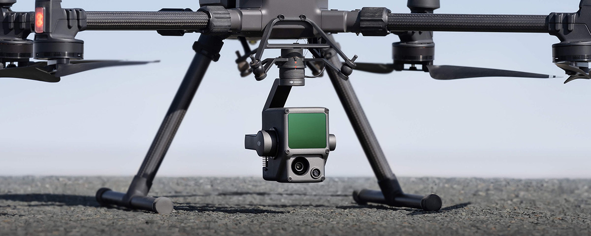
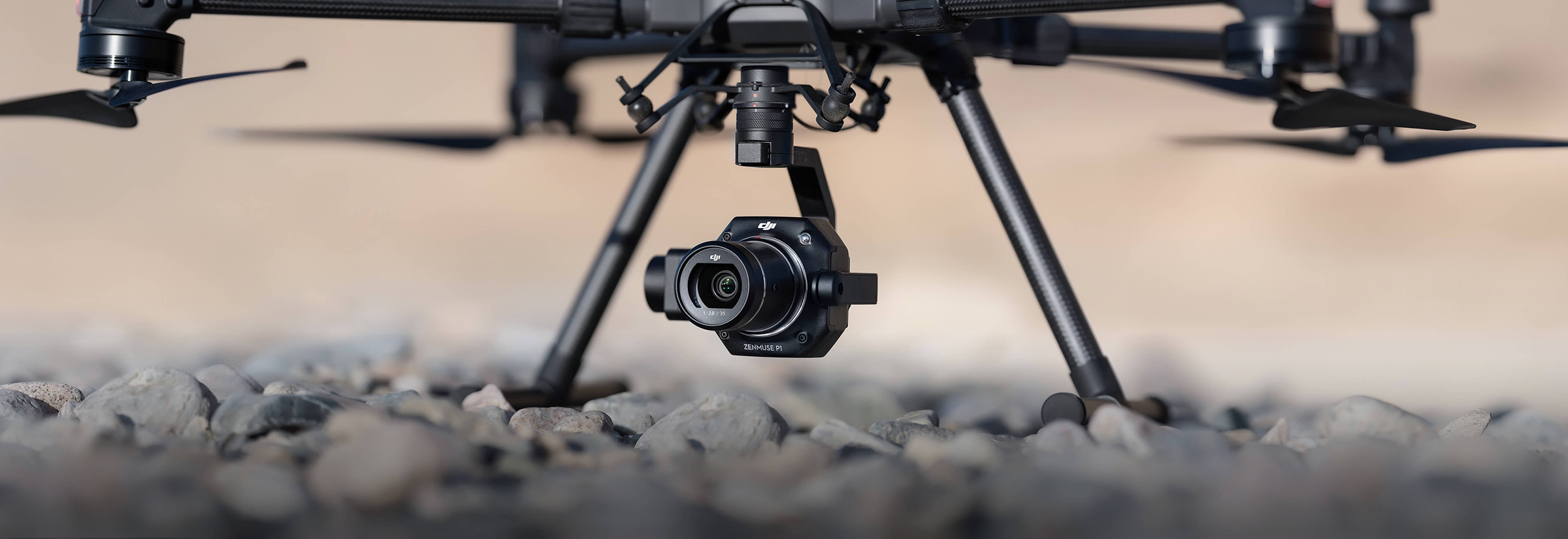
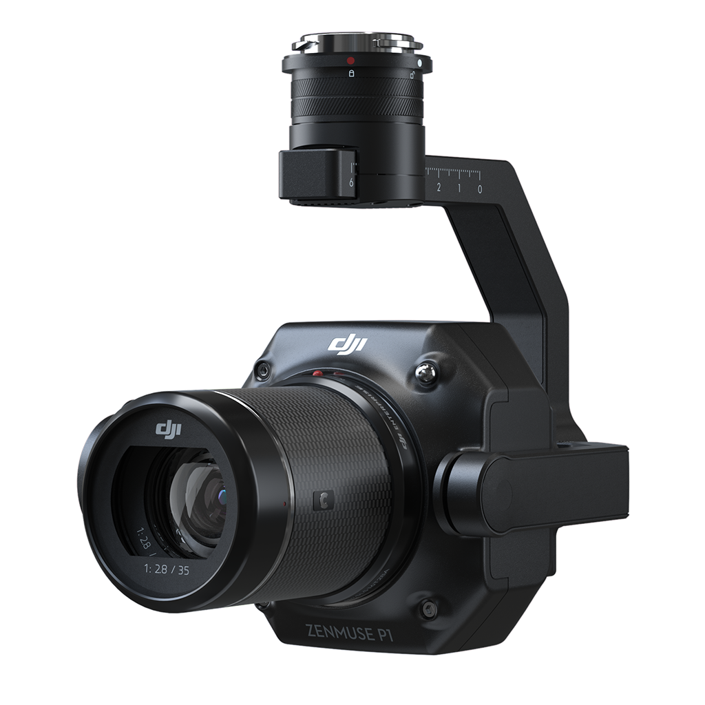
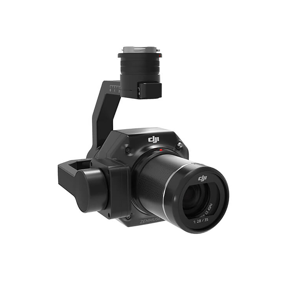
The Zenmuse P1 integrates a full-frame sensor with interchangeable fixed-focus lenses on a 3-axis stabilized gimbal. Designed for photogrammetry flight missions, it takes efficiency and accuracy to a whole new level.
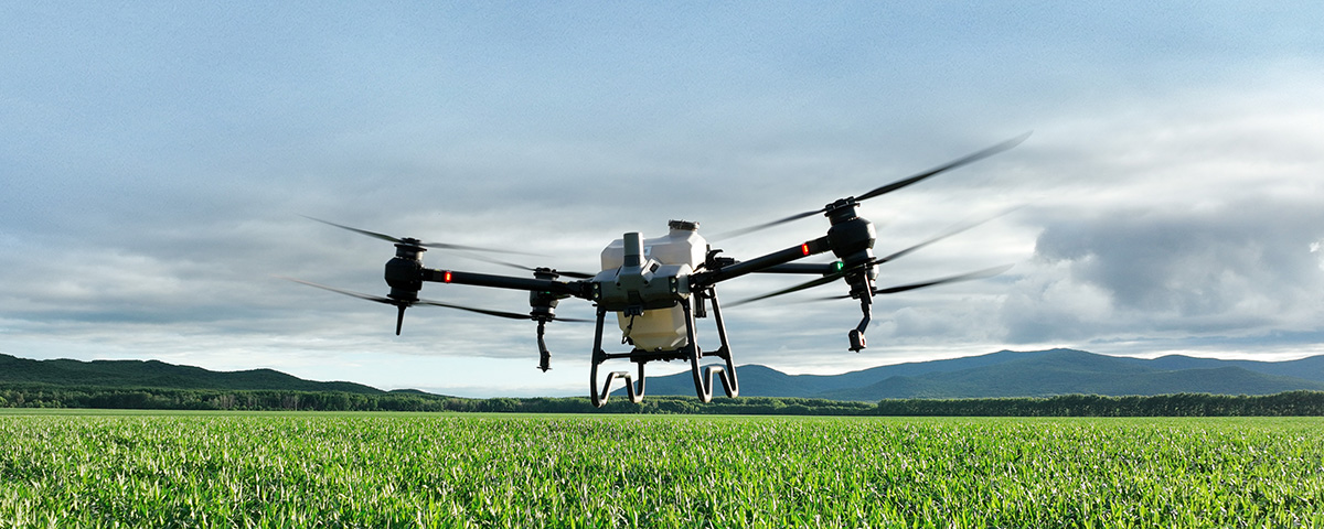
Drone surveying is becoming a necessary tool in the AEC industry (agricultural, engineering, and construction).
Today’s geological mapping industry is robbed of the excitement of previous death-defying stunts just to get that perfect oblique aerial photography. We owe that and more, to the latest M300 RTK DJI Zenmuse P1 specs.
It’s simply a camera with no crop factor, so it will not cut out your image.
DJI made a bold and brilliant move in making Zenmuse P1 lenses full-frame sensors that contain more microns in each pixel resulting in higher image quality of 45 megapixels, paired with short shooting intervals.
This makes Zenmuse P1 your best equipment to produce stunningly accurate photos during short flights.
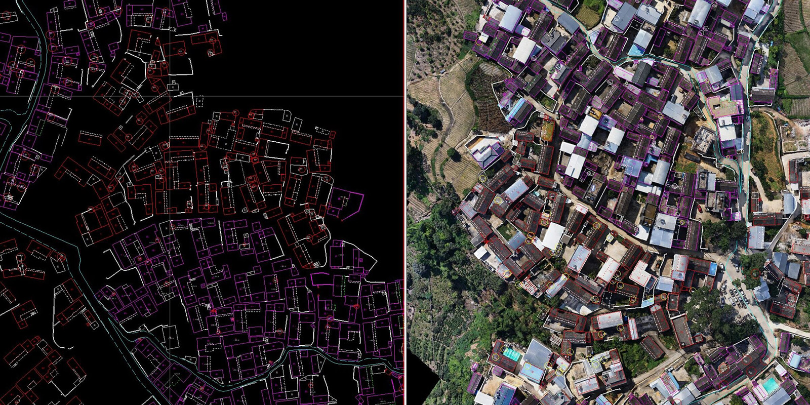
Photogrammetry or aerial photography is used in several fields like environmental studies, land use planning, movie productions, and many more. Three uses of vertical photography with the most impact on society: geological surveying, real-time mapping, and GIS for architecture and urban planning.
It is a study of engineering that uses systematic processes and surveying tools in investigating the earth’s geology. Geological surveying can be to create a model or extract the hydrocarbons and minerals underneath.
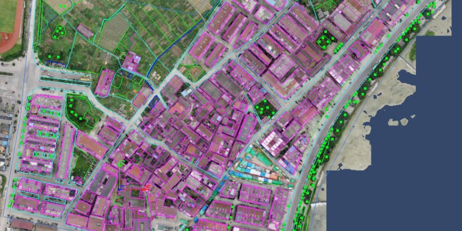
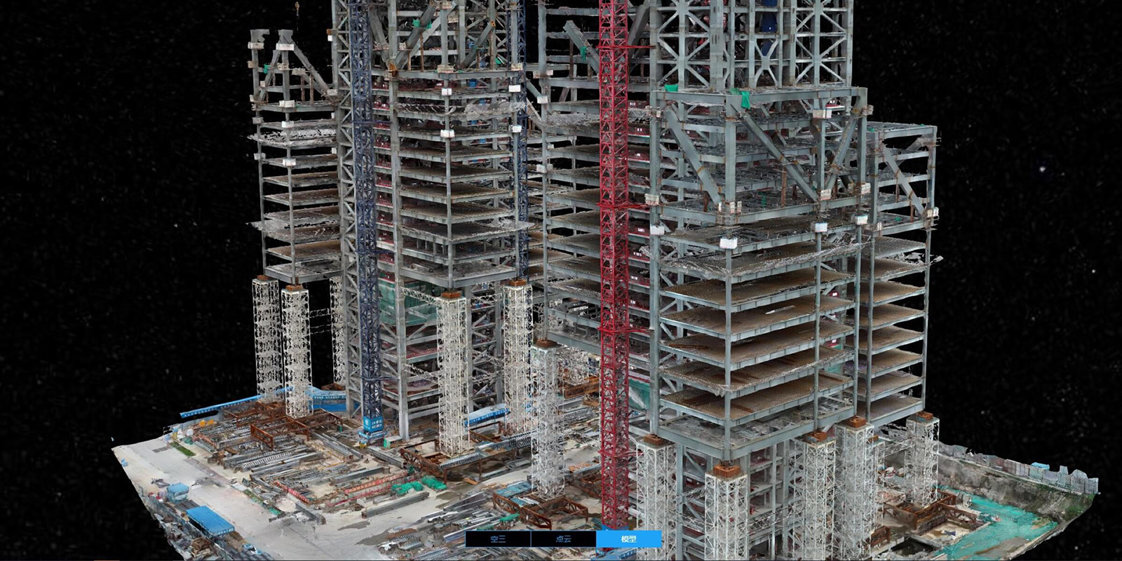
Zenmuse P1 footage can collect data in a 10 km squared 2D auto mosaic. It has an intelligent oblique capture for easy oblique photography to produce highly accurate 3D models.
When you are lost in the middle of nowhere or need the right directions to go to a client’s office, who do you call or, better yet, which app do you check out first? Google maps.
It shows real-time traffic so you can a void those dead-end lanes and even detailed pictures of streets. The Zenmuse P1 boasts a global mechanical shutter speed of 1 / 2000th seconds which prevents your pictures from having the “jello effect.” The wobble effect happens when the camera vibrates at a high frequency due to aerial drone shots at high-speed flights.
DJI Zenmuse P1 also has a built-in stabilizer that syncs and captures time across the 3 axis gimbal, the flight controller & its RTK module. All these work together to produce centimeter-level accurate data, which is most suited when a quick emergency response is needed.
Geographic Information System gathers, analyzes, and shows data about a unique geographic location. Mountain ranges, steep vertical slopes, and vast plains can be modelled with a millimetre level resolution so you can check, measure & evacuate hazardous areas.
Before M300 RTK and P1, GIS required you to rappel from ravenous cliffs, with one hand, all the same, while balancing your camera on the other. Now capturing 2D and 3D data for your construction life cycle has never been so easy.
Overall, the Zenmuse P1 and M300 RTK duo are efficient, intelligent, accurate, and safe. It definitely makes them the best investment for your various needs and functions plus prevents occupational hazards for your team along the way.
Safe. Reliable. Dependable.
Excluding applicable taxes and shipping.
46 -21330 56 Avenue
Langley, British Columbia
Canada
© Copyright 2012 – 2023 | Turn Tech Solutions | All Rights Reserved | DJI Enterprise Silver Partner | Design by Emma Hart