The CitySense is empowering cities. With cost-effective, powerful, and accurate data insights, this meticulous sensing software enables communities to target pollutants, enabling a cleaner and more sustainable environment.
On any job, real-time access is vital to ensure effectiveness and decrease costs. The CitySense’s operational status can be accessed remotely, meaning you have optimal functionality and ease of maintenance at your fingertips.
With colour-coded concentration data from the past 15 minutes, the CitySense shows the moving trails of vehicles, identifying current high-concentration road segments. The impact on surrounding areas can easily be accessed as well using real-time wind data.
The CitySense contains features which offer device ranking, concentration histogram plotting, and targetted device searches. This allows you to efficiently monitor and analyze real-time data from all active devices at once.
Using historical concentration maps, CitySense allows you to review and highlight 24-hour trends. With up to a billion data points and a dual-mode option, you can contrast these maps and identify the effectiveness of control policies from different periods and parameters.
Time-Lapse Animation for Historical Concentration Map:
Time-lapse animations allow you to depict concentration trends within a chosen time period. This visualization emphasizes the environmental changes seen over the course of time.
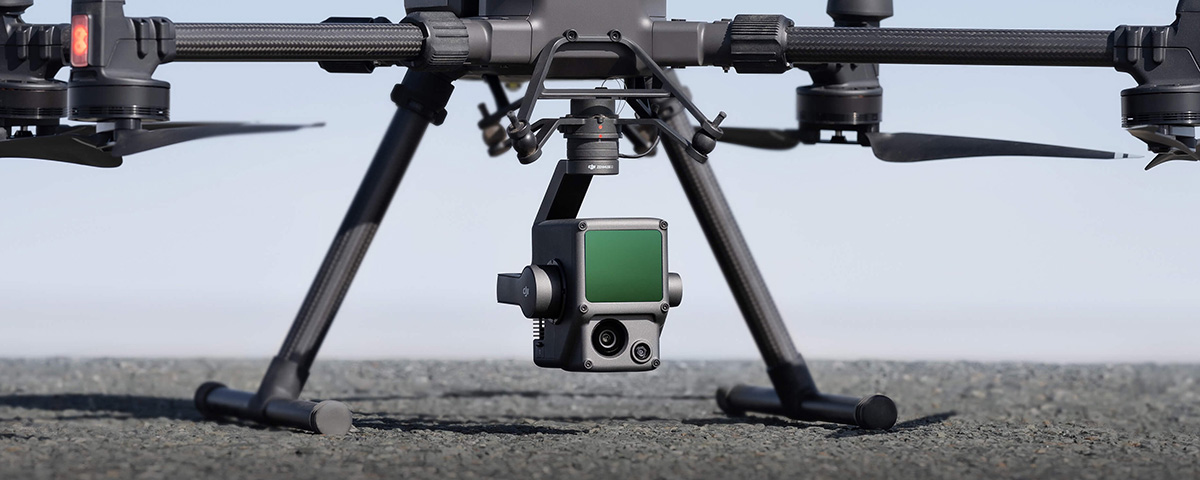
Diverse data sources are a powerful way to integrate ground measurement data. Using the CitySense hardware, UAV-mounted Sniffer4D measurement data, and Street View imagery allows you to see a holistic environmental view and more accurate environmental analysis.
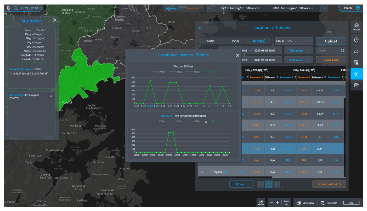
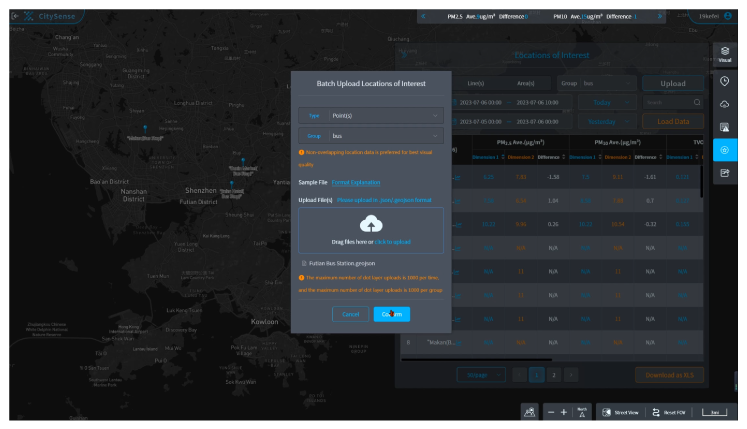
User-defined Locations of Interest: Points, Lines, and Areas
The CitySense system allows you to choose which data is most useful and beneficial to your project. Choose and define your points, lines, and areas of interest and receive tailored insight for specific concerning locations.
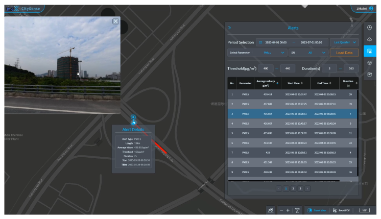
Critical environmental events require a nuanced approach. With CitySense, you can set predefined thresholds for a set duration. Should concentration levels exceed these thresholds, the system will automatically begin recording and capturing vital details for later review and analysis.
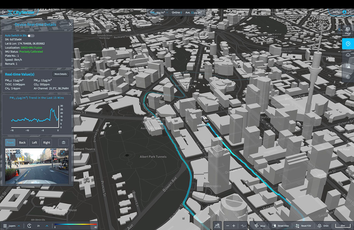
GNSS+IMU Precise Location Tracking
Even in high-rise urban environments, the CitySense system maintains reliable georeferencing for all measurement data.
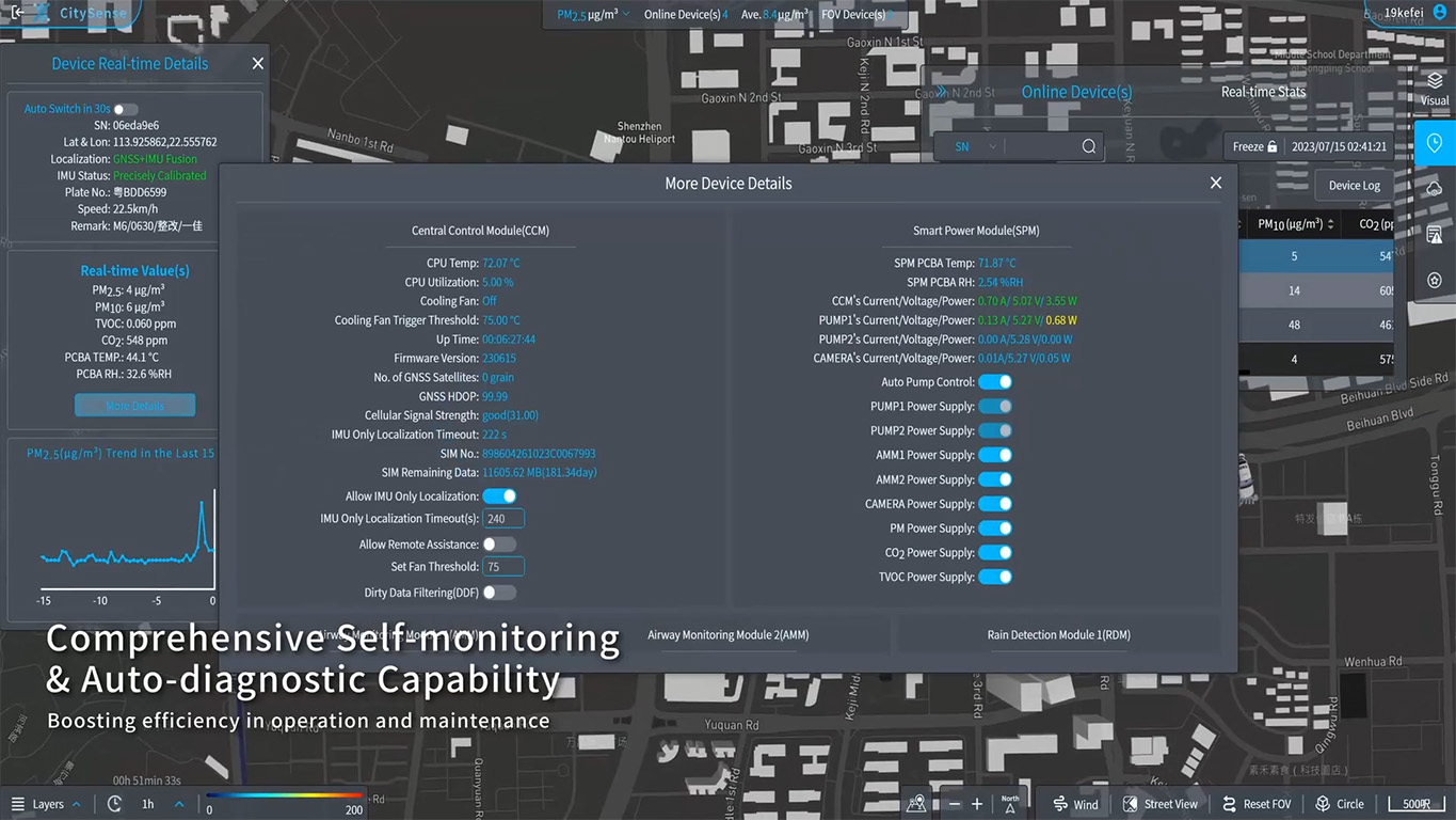
Advanced Self-Monitoring Capability
On any job, real-time access is vital to ensure effectiveness and decrease costs. The CitySense’s operational status can be accessed remotely, meaning you have optimal functionality and ease of maintenance at your fingertips.
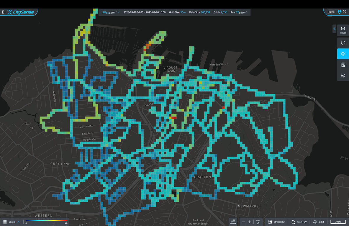
Real-Time Concentration Map
With colour-coded concentration data from the past 15 minutes, the CitySense shows the moving trails of vehicles, identifying current high-concentration road segments. The impact on surrounding areas can easily be accessed as well using real-time wind data.
Real-Time Data Analysis
The CitySense contains features which offer device ranking, concentration histogram plotting, and targetted device searches. This allows you to efficiently monitor and analyze real-time data from all active devices at once.
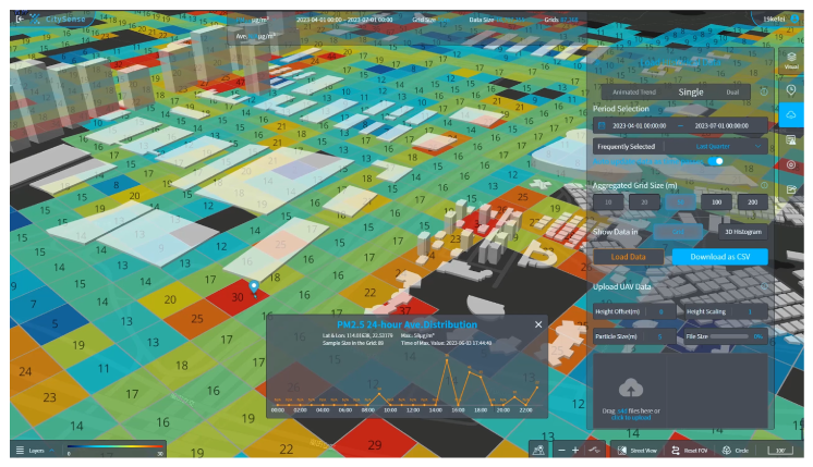
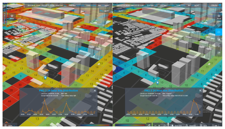
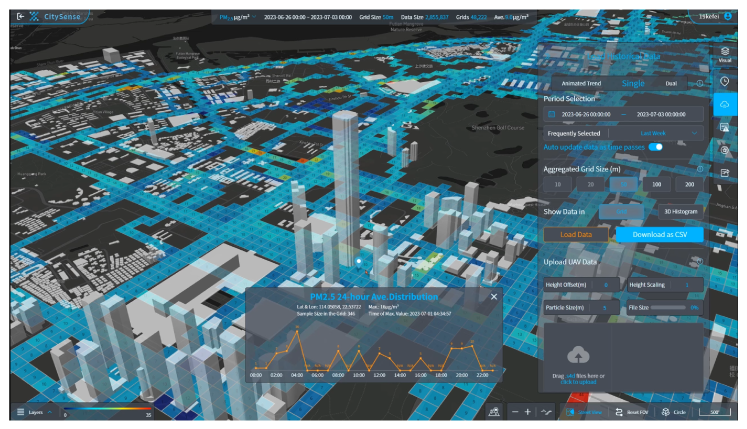
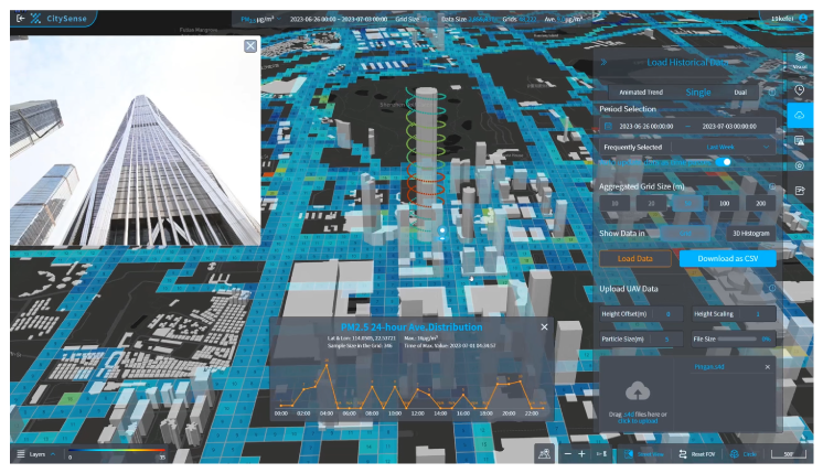
Historical Concentration Map, Both Single & Dual
Using historical concentration maps, CitySense allows you to review and highlight 24-hour trends. With up to a billion data points and a dual-mode option, you can contrast these maps and identify the effectiveness of control policies from different periods and parameters.
Time-Lapse Animation for Historical Concentration Map:
Time-lapse animations allow you to depict concentration trends within a chosen time period. This visualization emphasizes the environmental changes seen over the course of time.
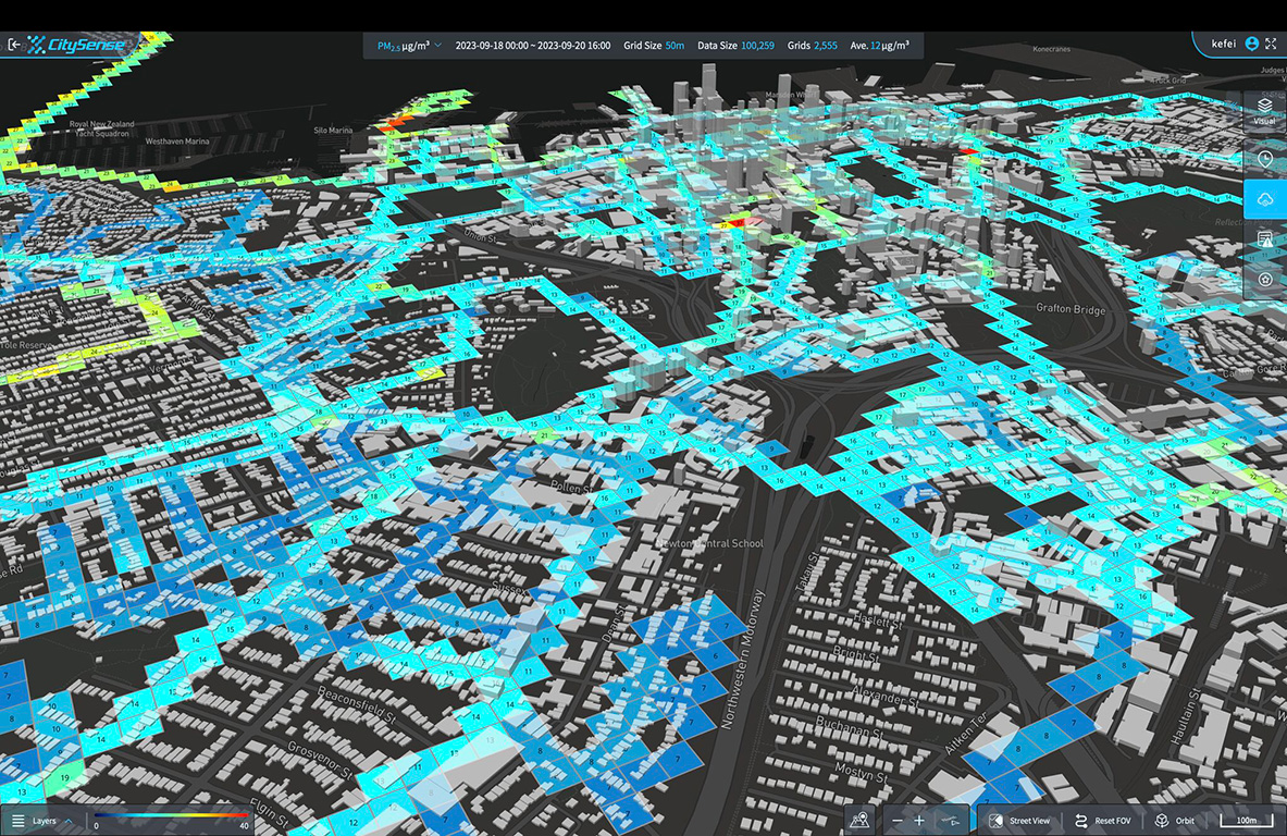
Multi-source Data Analysis for Historical Maps
Diverse data sources are a powerful way to integrate ground measurement data. Using the CitySense hardware, UAV-mounted Sniffer4D measurement data, and Street View imagery allows you to see a holistic environmental view and more accurate environmental analysis.
User-defined Locations of Interest: Points, Lines, and Areas
The CitySense system allows you to choose which data is most useful and beneficial to your project. Choose and define your points, lines, and areas of interest and receive tailored insight for specific concerning locations.
Critical Events Tracking
Critical environmental events require a nuanced approach. With CitySense, you can set predefined thresholds for a set duration. Should concentration levels exceed these thresholds, the system will automatically begin recording and capturing vital details for later review and analysis.
Applications: How the CitySense System Is Being Used Worldwide
The CitySense offers a number of useful applications. While attached to its vehicle system, the CitySense can be deployed to:
Identify natural gas leaks within urban centres
Identify high-air pollution areas for targeted mitigation efforts
Monitor air quality changes
Evaluate environmental policies and their effectiveness
Display real-time air quality data for public health
Map air quality in cities to inform and adjust urban planning and development
Help environmental science and public health research initiatives and efforts
Plus numerous project or industry-specific applications
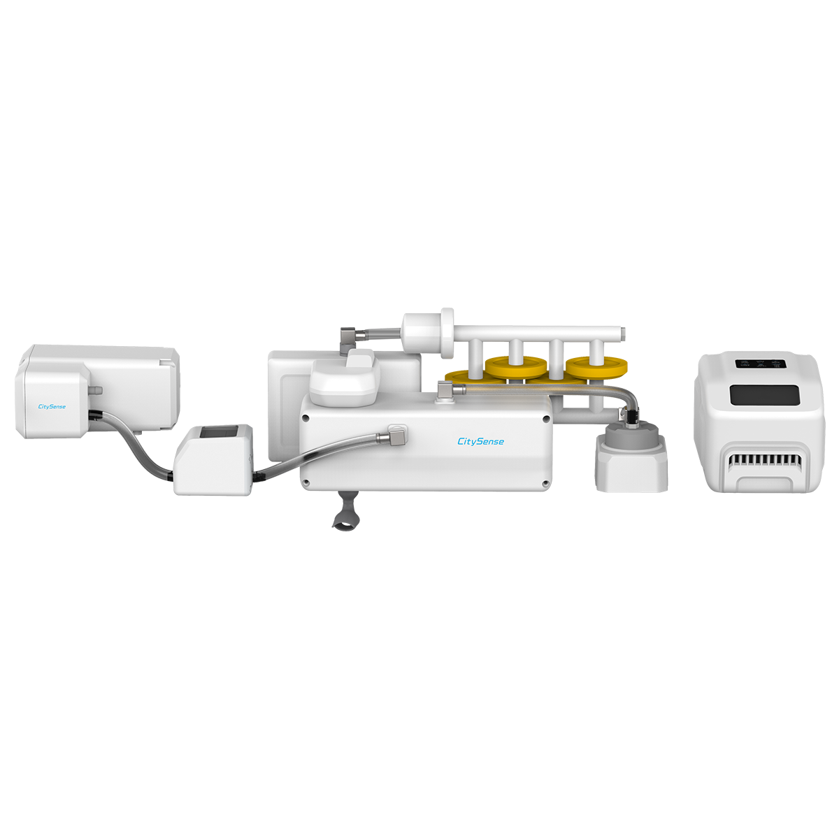
Choose Between Two CitySense Systems
CitySense-T
The CitySense-T is a compact version of the system. This version seamlessly integrates into the taxi lamp atop conventional taxis. Easily installed and an unobtrusive addition, this version minimally alters the vehicle’s appearance without sacrificing functionality.
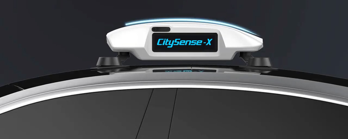
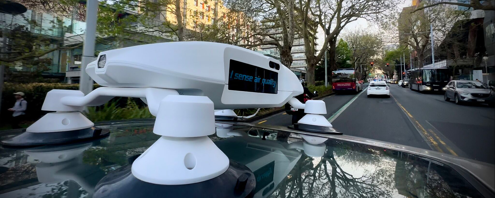
CitySense-X
Offering a weather-proof version suitable for a variety of vehicle installations, including busses, garbage trucks, and e-hailing taxis, the CitySense-X has an option for omnidirectional cameras and LED displays. Therefore, it offers a few extra features in addition to the same internal modules as the CitySense-T.
Ready to Learn More About How the CitySense Can Help You?
Contact us today to learn more about the CitySense System by Soarability and how it can revolutionize your city today. We offer free consultations from our team of professionals to make sure you get the right answers to all your questions.